Viewing elevation graphs
Most routes in StepWhere contain elevation data which can be viewed in graph format.
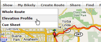
Simply click the Elevation button in the toolbar:
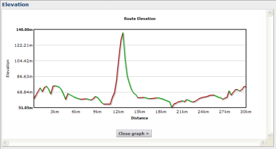
And an elevation graph will pop up:
If the route you are viewing does not have any elevation data, try again in 24 hours as it can take a while to retrieve the elevation data from the USGS GISDATA servers
See Also
- Comment on routes Share your thoughts on a StepWhere route in the community forum.